Upper Moore Creek
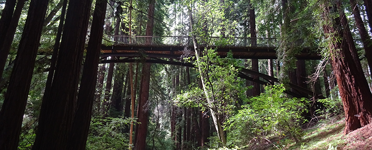
Pedestrian bridges cross Upper Moore Creek, providing vantage points for observing riparian forest canopy.
Upper Moore Creek (15 acres)
 General Description: The Moore Creek drainage is one of two extensive riparian corridors within the campus reserve (the other, longer corridor is Cave Gulch). The creek’s headwaters occur in the seep zone, north of the Baskin Engineering complex. The upper portion of the Moore Creek drainage within the reserve (Upper Moore Creek) begins just north of Kresge College, below the Heller Drive Bridge that leads towards the North Remote Parking lot, and continues south along the western edge of Heller Drive to its intersection with Meyer Drive. The lower portion of the drainage (Lower Moore Creek) starts just below Meyer Drive, north of the University House, and extends down “Chancellor’s ravine”. This area is readily seen from the paved Oakes Path, which leads towards the southern extent of College Eight and the northern extent of Oakes College. A second drainage joins this ravine below Oakes from the west, and the flatter, wider, channel passes below the dirt road paralleling the northern boundaries of the Center for Agroecology and Food Systems (CASFS; the Farm) and the Arboretum and empties into the historical Cowell reservoir now hidden within the Arboretum. From here, Moore Creek is then channeled under Empire Grade, where it runs through a portion of campus reserve land (The Triangle), off UCSC land and through Moore Creek Preserve, eventually draining into Antonelli’s Pond, and finally through Natural Bridges State Park where it enters the ocean.
Geology: Schist and marble are the major bedrock units underlying both the upper and lower reaches of the Moore Creek drainage (Stanley 1982). Just east of Porter College is a swallowhole, where Moore
Creek disappears underground into a subterranean area of fractured marble; further downstream some of the water reappears at the surface. Like sinkholes and caves, swallowholes are features of the campus’s karst topography. Rick Stanley (pers. comm. with Ken Norris, 1986) suggests that this and other swallowholes are of interest to researchers studying the campus hydrology system.
Arkley’s soil map (1963) shows that Felton rocky loam, with some areas of Hugo rocky loam, grades into Felton loam and Pinto loam as one moves down the upper half of Moore Creek drainage. Felton rocky loam is predominant in the ravine just south of the University House; Hugo rocky loam and Pinto loam (claypan variant) occur in the lowest stretch of the ravine.
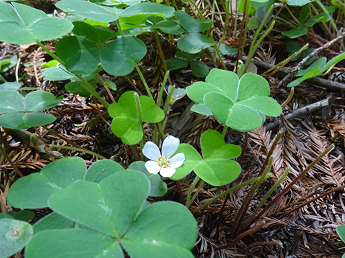
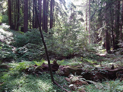
Plants: Mixed evergreen forest, composed of redwood (Sequoia sempervirens), Douglas-fir (Pseudotsuga menziesii), live oak (Quercus agrifolia), and California bay (Umbellularia californica), merges into dense redwood forest in the upper reaches of the drainage. Below the University House, the vegetation in the ravine is also mixed evergreen forest, and including a few big-leaf maples (Acer macrophyllum) and California buckeye (Aesculus californica). The upper reach of Moore Creek is used as recreational area and has thus the vegetation has been somewhat altered (Weiner and Norris 1983).
Animals: According to Luckenbach (1983), mixed evergreen forest supports more vertebrate species than any other vegetation community on campus. In addition, the slow-moving water at the base of Chancellor’s ravine will remain on the surface into the dry season, attracting many animal species such as bobcats (Lnyx rufus), mountain lions (Puma concolor), coyotes, rough-skinned newts (Taricha granulosa), and a variety of birds. This area was the site of a restoration project in the 1990s, in which students planted willows (Salix spp.) and made small check dams to create breeding pools for California red-legged frogs (Rana draytonii). These willows have become very dense, shading out the frog pools which have filled with sediment (A. Jones, pers. obs). The area, however, may provide important dispersal habitat for R. draytonii juveniles and overwintering sites for adults.
 Management: Erosion control features such as check dams and step pools are planned for the Upper Moore Creek drainage as part of the UCSC’s Stormwater Management Plan. This area features a popular (unauthorized) mountain biking trail that is used to bypass Heller Drive between Kresge and Porter, and which crosses the ravine’s seasonal creek bed and likely contributes to erosion. Trail widening has also resulted in vegetation loss along the bottom and lower slopes of the ravine (A. Jones, pers. obs.).
Opportunities for teaching, research, and stewardship: The variety of habitats along Moore Creek, combined with its riparian character, make the corridor a valuable study site. Three types of riparian area—swiftly-flowing water in the steeper portion of the ravine (during rain events), slow-moving water in the creek bottom, and standing water in the old reservoir and an old cattle trough—provide habitat for nearly all orders of terrestrial invertebrates (Professors Todd Newberry and John Pearse, pers.comm. with K. Norris, 1986). Professor Fox noted that the area where oak-madrone woodland borders grassland at the upper edge of Chancellor’s ravine is also rich with invertebrate life, especially spiders. This portion of the reserve is accessible for classes, though its heavy recreational use and short sight-lines makes it somewhat dangerous to lead a large group in the area. Trail maintenance, erosion control, and invasive species management are possible stewardship activities in this parcel. Several large deer exclosures were erected in the past but are currently (2016) in disuse and disrepair.
